

Relief wall map that covers the Tour of Mont Blanc.
A finishing frame is also available as an option: We highly recommend it to make hanging easier and to enhance the appearance of your map.
Information included on the map:
– General data:
• Hydrological, natural and hypsometric data – Administrative data
• Glaciers, vertices, rocks
– Sports sites, Hiking:
• Ascension of Mont Blanc
• Large hiking trails
• Refuge and cottage
• Canyoning sites • Ski lift
• Belvédères, Orientation Tables < BR> • Ski Resorts
• Live Water Activity
• Paragliding Practice Sites (www.ffvl.com)
• Takeoffs, Landings
• Airports, Aerodromes
– Scale & Dimensions:
• Planimetric Scale: 1: 200 000
• Altimetry Scale: 1: 120,000
• 19.5 cm x 29.5 cm
Related products

New Collections
New Collections
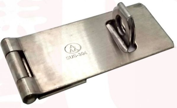
AAA S/S Hasp & Stapler 2″ | Model : HSPL-SL Sale Visa Payment
New Collections
New Collections