
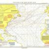
A Chart Showing Part of the Coast of NW America (Vancouver’s Chart, No. 2) shows half of a chart of the coast of the Alaskan Panhandle and British Columbia including the Admiralty Island, Lynn Canal, and Prince Frederick’s Sound. An antique black and white map perfect for framing, this map was published in November 1899 as half of a two – map set with the article “The Alaskan Boundary.”
Related products

Forms, Recordkeeping & Money Han
Biblia de Estudio Pastoral Ceremonias y Sermones RVC Grande Letra Grande Tapa Dura Azul-Gris Ebay

Calendars, Planners & Personal O
Agenda Finocam YEAR Azul 16,5 x 24,2 cm 2025 Buy Cheap Visit
Book Covers & Book Accessories
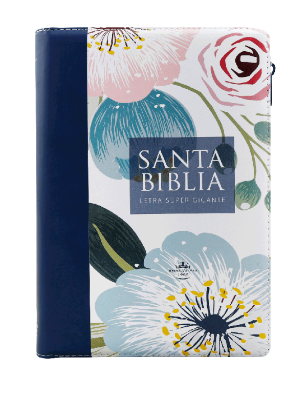
Biblia de letra super gigante 19 puntos RV1960 Cierre e índice Cheap Pice Outlet

Office & School Supplies
Libreta devocional con anillas: Mis momentos con Dios. Modelo Elegancia Azul Discount Footaction